

Orbitron
About Orbitron
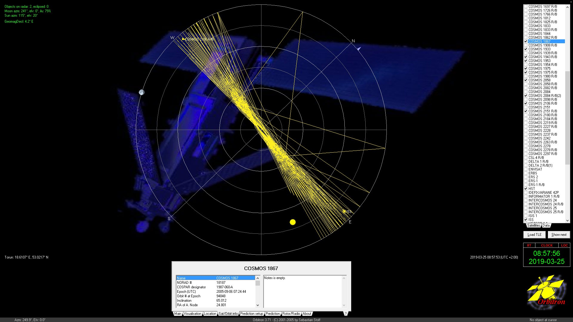
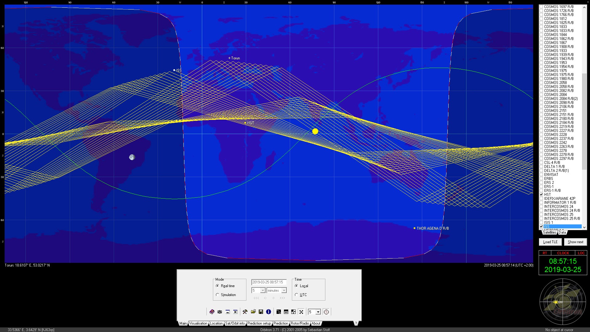
Orbitron shows you where the satellites are. Load a set of orbital elements, the two-line text records that describe each object’s path, and pick the ones you care about. The program draws them on a world map in real time, with their ground tracks and footprints, and on a radar view that shows where in your sky each one sits.
Set a location, and a search finds every pass over the next days with rise time, peak elevation and set time. Connect a radio and a rotator, and it tunes the frequency for Doppler shift and points the antenna as the satellite crosses. It also tracks the Sun and the Moon.
It belongs to the amateur radio and weather-satellite hobby. The everyday tasks there are catching a weather image from a polar orbiter, working a voice contact through a repeater in orbit, or spotting the space station on a clear evening.
Orbitron has been the standard desktop tracker in that world for a long time and is no longer being developed, which in this case means the physics it does has not changed either. Newer tools do the same job with a modern face. This one does it with a small window, a dark night mode and connections to radio software that other trackers never matched.
Loading satellites and keeping the elements fresh
Everything starts with the TLE files, the text records that describe each orbit. Orbitron loads them from files on disk and can hold up to twenty thousand objects at once, all tracked simultaneously, with checkboxes to choose which appear on the map.
The TLE Updater fetches fresh files over the web from sources you list, with support for zipped sets, and the manual’s advice is to update at least weekly and always before a session. Stale elements produce a satellite drawn a few degrees from where it is, which is the commonest cause of a missed pass.
Each object carries its orbital details, its NORAD number and designator, an orbit count, and a notes field for your own remarks, such as the frequency and mode of a repeater. A built-in database of satellite frequencies fills some of that in.
A database of cities sets your observer location by name rather than coordinates, though typing the coordinates from a phone’s GPS is more exact.
The map, the radar and simulation mode
The main Orbitron window is a world map with the selected satellites drawn as icons, their footprint circles showing where on the ground they are visible, and their ground tracks ahead and behind. The map is flat and schematic. For a globe with real imagery, a virtual globe with satellite photography is a different kind of tool and a pleasant companion to this one. Day and night are shaded across the map and the Sun and Moon are plotted.
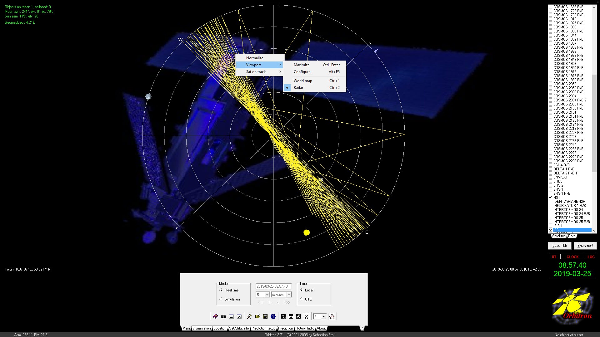
The radar view swaps the map for a circular plot of your sky, azimuth around the edge and elevation towards the centre, with each visible satellite’s path drawn across it. That is the view you glance at while pointing an antenna by hand.
A time control switches between real time and simulation. In simulation the clock runs forwards or backwards at any speed, or jumps to a moment. A pass predicted for tomorrow evening can be watched in advance to see where in the sky it rises and how high it climbs.
The Nightlife colour scheme darkens everything for use outdoors, and a full-screen presentation mode suits a club meeting or a classroom.
Predicting passes and Iridium flares
The Orbitron pass search is the planning tool. Choose satellites, a time range and a minimum elevation. The results list every pass with acquisition time, maximum elevation with its azimuth, loss of signal and duration, ready to print. Setting the minimum elevation to twenty or thirty degrees filters out the passes that skim the horizon and never produce a usable signal. Newcomers learn that setting after a week of disappointing captures.
A separate search predicts Iridium flares, the brief bright reflections from the antennas of a particular constellation, with time and brightness for your location. Fewer of those satellites still flare than once did, but for the ones that remain the prediction still works.
For stargazing beyond satellites, a planetarium that shows the whole night sky is the companion program.
Radio and rotator control
This is the feature that keeps Orbitron on the desks of people who could have moved to something newer. As a satellite crosses the sky its signal shifts in frequency, arriving high as it approaches and low as it recedes. The program corrects for that.
Enter the satellite’s downlink frequency in its notes and connect the program to radio software through its driver interface. The receive frequency then follows the Doppler curve through the pass without a hand on the dial. The widely used software-defined radio receivers accept the correction through a small bridge plugin, which is how most weather-satellite images get captured today.
Rotator control works the same way. The program sends azimuth and elevation to a rotator interface, built in for the common controllers and through a user-written driver for the rest. A tracking antenna then follows the satellite automatically.
The remaining setup is the frequency for each satellite and the serial connection to the hardware. Once done, a pass runs itself from acquisition to loss of signal. Anyone doing digital modes through a satellite pairs this with a program that decodes and encodes digital radio modes, the tracker handling the tuning and the decoder handling the sound.
The clock and the screensaver
PC clock synchronisation through a time server sits in the Orbitron options, and it matters more than it sounds. A clock two seconds out puts a fast low satellite noticeably off its predicted position, and the manual repeats the point. A screensaver installs alongside, showing the map and the tracked satellites when the machine idles.
For pointing a dish at a geostationary satellite rather than tracking a moving one, a dish alignment calculator is the neighbouring tool, since this program’s strength is the objects that move.
Conclusion
Orbitron is for the radio amateur, the weather-satellite hobbyist and the sky watcher who wants passes predicted and a radar view to point by. A radio that tunes itself through the shift as the satellite crosses is the bonus. The rotator and radio control are the reasons it remains installed on machines that could run anything newer.
It is unmaintained and it looks it. Anyone who wants a large map on a large screen has more modern choices. Keep the elements fresh and the clock exact, and the physics inside it is still right.
Pros & Cons
- Tracks up to twenty thousand satellites at once on a world map and a radar view
- Pass prediction with elevation filtering, printable, plus Iridium flare search
- Doppler-corrected frequency control of radio software during a pass
- Rotator control for automatic antenna pointing
- Simulation mode to rehearse a pass before it happens
- Dark night scheme with a full-screen mode and a screensaver
- No longer developed, with an interface sized for older screens
- Elements go stale within a week without the updater
- Radio and rotator setup needs driver configuration and a manual
- Iridium flare prediction matters less as those satellites retire
Frequently asked questions
The orbital elements are old or the computer clock is wrong. Run the TLE Updater to fetch fresh elements, and synchronise the clock from the options, since a few seconds of error moves a low satellite visibly.
Enter the downlink frequency in the satellite's notes, then connect the program to your radio software through the Rotor/Radio setup and its driver or bridge plugin. The receive frequency follows the pass automatically.
In the pass search, set a minimum elevation of twenty to thirty degrees. Passes below that skim the horizon and rarely give a usable signal.
Yes. Switch from real time to simulation mode, set the date and time, and the map and radar show the satellite's position and path at that moment.


